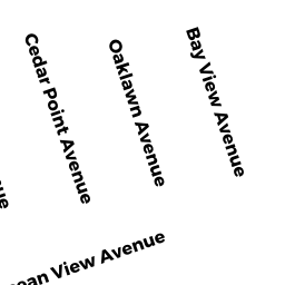
5 CEDAR POINT AV
Owner Information
DILL RUSSELL E & JOAN E
133 CUNNINGHAM DR
DAVENPORT, FL 33837


Property Details
5 CEDAR POINT AV is classified as a Single Family Residential (Ranch).
The primary structure on this property was built in 1945. There are 1,920ft2 of built area within this property. There is 864ft2 of residential/living space within this property. This property is listed as having 4 rooms.
5 CEDAR POINT AV is valued at $344,608. The land is valued at $213,408 and the structures are valued at $128,300. There is an additional valuation of $2,900 on this property.
This property is in Zone W30. Confirm with local Zoning Board authorities to ensure there are no overlays or other easements on this property.
The most recent deed for 5 CEDAR POINT AV is recorded at the local registrar in Book 17922, Page 199. 5 CEDAR POINT AV was last sold on Friday, October 1, 1999 for $1.
Assessment data from fiscal year 2022.
Flood Data
According to the FEMA National Flood Hazard Layer, this property does not appear to be in a flood zone. It may also be in an area not yet reviewed. Nonetheless, confirm this information prior to taking any action.
To view the flood hazards around this property, create a FEMA "Firmette" Map of the area around 5 CEDAR POINT AV.
Broadband Internet Providers
| Provider | Type | Bandwidth (mbps) | |
|---|---|---|---|
| Comcast | Cable | 1000 | 35 |
| VSAT Systems, LLC. | Satellite | 2 | 1 |
| Viasat Inc | Satellite | 35 | 3 |
| HughesNet | Satellite | 25 | 3 |
| GCI Communication Corp. | Satellite | 0 | 0 |
| Verizon New England Inc. | Fiber | 940 | 880 |
Broadband service provider data from December 2020.
Adjacent Properties
- 4 KERWIN AV
Single Family Residential owned by GAIL V CARLSON - 15 OCEAN VIEW AV
Single Family Residential owned by LEWIS KENT A - 6 KERWIN AV
Single Family Residential owned by YODER SHAWN W & CYNTHIA L - 8 KERWIN AV
Single Family Residential owned by LOTTERO BARBARA JEAN - 7 CEDAR POINT AV
Single Family Residential owned by DILL ANDREW N TRUSTEE